
There has been much said of the roles of traditional and electronic navigation techniques in recent years. For my own part I consider GPS chart plotters to be the tool to tell you where you are and where you are heading, and paper charts, along with almanacs and tidal stream atlases, are the essential tools for planning. Having spent much of my life learning navigation, not only at sea but on land and in the air, I thought I had everything needed in my navigational toolbox. However, last year I added something new.
In May my wife Sarah and I began a 2,142-mile cruise from Devon to Scotland, returning in September. We sailed aboard Mollymawk, our Pan Oceanic 38, a cutter-rigged sloop with a pilot house and eminently suited for such a voyage. An old friend joined us as far as Strangford Lough and, as a ‘superannuated navigation officer’, John showed us a little of one of the tools he used in the Royal Navy while navigating a frigate and a nuclear submarine. He learnt the basics on two navigation courses, developing them at sea, and was therefore very surprised that I did not employ what he considered to be a standard planning method. We therefore had to improvise at the beginning as I had not shipped any graph paper.
The method John showed me is very straightforward, easy to remember, and indispensable for planning any passages where there are time constraints. Essentially it is the use of a distance-time graph, familiar to anyone from schooldays and also to sailors who are ex Royal Navy, but it is certainly not part of any RYA course that I have undertaken. The real trick is that it allows you to see how a passage is progressing and gives you the information you need to make sound and timely decisions without having to think too hard.
1 Creating the graph
This story is from the {{IssueName}} edition of {{MagazineName}}.
Start your 7-day Magzter GOLD free trial to access thousands of curated premium stories, and 9,000+ magazines and newspapers.
Already a subscriber ? Sign In
This story is from the {{IssueName}} edition of {{MagazineName}}.
Start your 7-day Magzter GOLD free trial to access thousands of curated premium stories, and 9,000+ magazines and newspapers.
Already a subscriber? Sign In
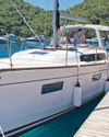
I WAS THE ONLY SAILOR ON OUR FAMILY CHARTER AND IT HAD TO GO WELL
Crystal waters, cliff tombs and sunken outboards lain Willis wanted to ensure plain sailing for his family’s first charter around Turkey's Lycian Coast

HOW IT WORKS SEAWATER PUMP
The water and oil seals on a water pump shaft will eventually wear with time, leading to pump-shaft corrosion or loss of engine oil.

THOUSANDS OF MILES ACROSS THE INDIAN OCEAN
Floris and Ivar battled severe weather and cross swell to sail from Australia to South Africa, but there were beautiful islands on the way

The secret of yachts with enduring appeal
Fashions come and go, but J-Boats remain a safe choice for great sailing boats, whether you want to own it for ever or sell it

Tragic sinking of Bayesian; Italian prosecutors investigate
The sinking of the Bayesian superyacht in reportedly only 16 minutes and the tragic loss of seven lives has sent a shudder through the sailing community and beyond.
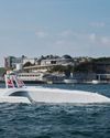
THE ADVENT OF MARINE AI TECHNOLOGY
Fonathon Savill reports on the revolutionary impact artificial intelligence is about to have on all areas of life at sea
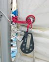
IMPROVING SINGLE-LINE REEFING
Martin Watts explains how to reduce the friction on the reefing lines of newer yachts
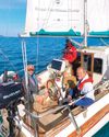
The secrets of skippering a successful cruise
Setting off on a cruise is easy, but planning a route that keeps your options open and ensures the enjoyment of all on board is more of an art

CRUISING THE KINGDOM OF THE ISLES
Joanna Martin and her husband Mark sail across the Irish Sea to the legendary sea kingdom and to draw the wonderful wildlife there

MOODY DS48
Can a boat built for long-term, long-distance cruising and offering one-level living still deliver an enjoyable sailing experience? Theo Stocker sets sail across the English Channel to find out