
Coastal influences here usually prevent winter temperatures from dropping down into the single-digit range common in the rest of Maine, but pilots should keep in mind that KBHB receives an average of 60 inches of snow. In May and June, there can also be dense coastal fog to plague unwary pilots.
A. STANDARD T-BAR IAF POINTS
Whenever possible, GPS approaches are developed using a “T-Bar” shape. In this case, the final approach course is 224 degrees inbound with initial approach fix points CARDA and DIRNE to the northwest and southeast that require no more than 90-degree turn inbound and eliminate the need for a turn around the holding pattern.
B. DIFFERING GLIDESLOPES
This story is from the {{IssueName}} edition of {{MagazineName}}.
Start your 7-day Magzter GOLD free trial to access thousands of curated premium stories, and 9,000+ magazines and newspapers.
Already a subscriber ? Sign In
This story is from the {{IssueName}} edition of {{MagazineName}}.
Start your 7-day Magzter GOLD free trial to access thousands of curated premium stories, and 9,000+ magazines and newspapers.
Already a subscriber? Sign In
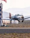
The Temple of Speed
Reno entices even this altitude-oriented pilot.

Flat Sixes
Fanatical artisans
Blue over Green, Tent in Between
I’m old , I’m cranky. Why do I keep air-camping?
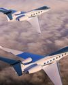
Gulfstream Reveals G400, G800
The product lineup gains large-cabin and ultralong-range mounts.
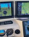
Every Airplane Requires a Checkout
Embrace the challenge of mastering a new machine.

Fuhggedaboutit
Fifty-plus years of f lying forgetfulness
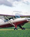
THE MAULE FAMILY APPROACHABLE AIRCRAFT
Choose your mount —the Maules do it all.

Sisters
“ Women certainly have the courage and tenacity required for long flights.” —Mildred Doran
INSIDE OUT OR OUTSIDE IN?
What kind of pilot should you be?
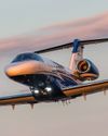
WE FLY: CESSNA CITATION CJ4 GEN2
THE FLAGSHIP CJ JUST GOT A WHOLE LOT BETTER.