يحاول ذهب - حر
Mapping A Sustainable Future
August 2016
|Geospatial World
How open data is helping Nepal to commercialize agriculture.

Ensuring effective agriculture production across the country has been a serious challenge due to high degree of spatial and temporal climate variability coupled with lack of agricultural datasets and technology. This is because many farmers use traditional practices in agriculture and there is a lack of commercialization in agriculture. Moreover, there is a lack of data on what is grown where. So, government and non-government organizations find it hard to plan changes that might prove effective. Also, the youth in Nepal today is disengaged with their community, and is looking to migrate to other countries for better opportunities.
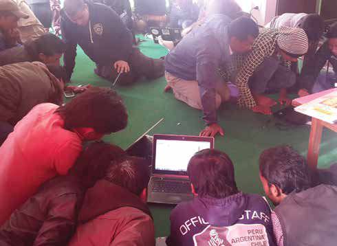
Local knowledge and crowdsourcing

هذه القصة من طبعة August 2016 من Geospatial World.
اشترك في Magzter GOLD للوصول إلى آلاف القصص المتميزة المنسقة، وأكثر من 9000 مجلة وصحيفة.
هل أنت مشترك بالفعل؟ تسجيل الدخول
المزيد من القصص من Geospatial World

Geospatial World
Advanced Image And Signal Processing To Affordable Launch Systems: The Excitement Continues
Space has once again become the “new frontier” with capabilities such as in-orbit satellite servicing and in-orbit assembly incessantly challenging the human mind. Intriguing geospatial innovations have blurred the difference between reality and science-fiction. Such developments are exciting and encouraging, MDA CEO Howard Lance tells in an exclusive interview
5 mins
July-August 2017

Geospatial World
40 Years Of Disruptive Innovation In 3D
40 Years Of Disruptive Innovation In 3D
4 mins
July-August 2017

Geospatial World
Cleaning Up Space Debris
A spacecraft thruster that fuels itself by eating space junks is all set to take off with the Airbus Bartolomeo mission.
4 mins
July-August 2017

Geospatial World
Newest In The Self-driving Cars Mix- Rental Companies
With numerous talks about how autonomous vehicles are going to transform the transportation industry, rental car companies are making sure they don’t lag behind.
3 mins
July-August 2017

Geospatial World
Mapping Sanitation
Hexagon Geospatial’s technology is helping an Indian city resolve its poor sanitation and provide a better life to the less affluent communities.
3 mins
July-August 2017

Geospatial World
How Satellites Are Rebooting Building Design
Today’s electromagnetic and earth observation systems are propelling a future-habitats’ design movement that could be named Astrospatial Architecture.
14 mins
July-August 2017
Geospatial World
Luciad's Smart City
Solution Makes Real Time Data Visualization Easy
2 mins
September-October 2017
Geospatial World
Satellite Imagery+Crop Insurance=Small Holder Farmer's Gain
Satellite intelligence is enriching new insurance products aimed at helping India's smallholders to withstand climate shocks
5 mins
September-October 2017

Geospatial World
He Rocked the Mapping World
THE HARDER THE STRUGGLE, THE more glorious the triumph. But not many people have the courage to persevere in the face of failures.
5 mins
January 2017

Geospatial World
Rolling in the Deep
WHEN IT COMES TO choosing a career path, India has a long tradition of following the family practise. It is pretty common to see a doctor’s son taking up medicine or a chartered accountant’s daughter joining her father’s firm. So, when the son of the Dean of the city’s medical college and the grandson of the state’s most prominent physician decided to break the family tradition, quite a few eyebrows were raised.
5 mins
January/February 2017
Translate
Change font size