Boaters Can Contribute Cartography And Debris/Wreck Locations.

Navionics, the leader in content and location-based services for the recreational boating market, is partnering with fellow industry leaders and the South Florida boating community to remap marine and inland waterways affected by Hurricane Irma.
When the hurricane passed through the area on September 10, 2017, hundreds of boats were sunk, docks wrecked, and shorelines and bottom contours changed.
By working together, the remapping initiative will improve boater safety in these areas. The month-long event is set to kick off January 19, 2018. Individuals wishing to participate are invited to record their sonar logs and upload data to Navionics, as well as to add marine debris locations throughout South Florida.
Recording and uploading sonar logs to Navionics can be easily done from any boat, because Navionics accepts sonar data from all major plotter/sonar brands. Boaters can record sonar logs on their plotter, then send them to Navionics via Wi- Fi or upload the logs from the plotter card using a computer.
Depth data can also be shared through the SonarChart Live feature which creates maps in real time. The depth data will be processed and made available as an updated SonarChart 1 ft HD bathymetry map.
Participants are also encouraged to mark debris areas using the Community Edits tool of the Navionics Boating app, allowing mariners to be aware of potential hazards. Navionics will share the debris locations with National Oceanic and Atmospheric Administration, who will then have it physically removed.
Navionics Nautical Chart will also be updated to include coastline corrections, Notices to Mariners, and the integration of future NOAA Chart editions when issued. The new content will be available as daily updates, easy to download for plotter and mobile, and directly visible on the Navionics website for anyone to see.
この記事は Passage Maker の March 2018 版に掲載されています。
7 日間の Magzter GOLD 無料トライアルを開始して、何千もの厳選されたプレミアム ストーリー、9,000 以上の雑誌や新聞にアクセスしてください。
すでに購読者です ? サインイン
この記事は Passage Maker の March 2018 版に掲載されています。
7 日間の Magzter GOLD 無料トライアルを開始して、何千もの厳選されたプレミアム ストーリー、9,000 以上の雑誌や新聞にアクセスしてください。
すでに購読者です? サインイン
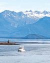
Nord2AK: Nordhavn's 2016 Rendezvous
The seeds were planted in 2012. We had been cruising for several weeks in the remote waters of northern British Columbia, where it isn’t unusual to go for several days without seeing another boat. Then surprisingly, two other Nordhavns sailed into Sea Otter Cove where we were anchored on the west side of Vancouver Island.
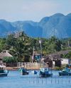
Cuban Sojourn
The second part of a journey along Cuba’s northern coast.

Shop Talk
Daniel Harper Q&A Founder & CEO of Siren Marine talks with us about how marine products are beginning to take advantage of onboard data.
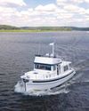
Bye, Bye, Birdie #5
The Need for Speed
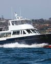
On The Water Duffield 58
It’s not every day that a brand-new 58-foot performance trawler appears on the marketplace radar, but that seems to have happened with the debut of the Duffield 58 Motoryacht.
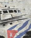
Castro's Mystery Motoryacht
Gianma and the voyage that changed the world.

Bye, Bye, Birdie #6
A Star to Steer Her By.
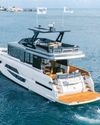
Glass Living
Testing the Modern and Versatile Okean 50.
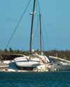
Navionics Spearheads Post-Irma Re-Mapping Effort
Boaters Can Contribute Cartography And Debris/Wreck Locations.
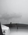
Coping With Fog
Dealing With One of the Most Dangerous Elements of Seamanship.