BYE BYE BIRDIE # 2 Bathymetric Navigation

Bathymetry, as per Merriam-Webster, is defined as, “The measurement of water depth at various places in a body of water; also: the information derived from such measurements.”
BATYMETRIC NAVIGATION: LINE OF SOUNDING METHOD
Even vessels with the most austere complement of navigation electronics will usually have a depth sounder. Rarely, however, do we recognize the full utility of this unassuming tool, especially for navigation in the absence of GPS.
I first learned the art of navigation aboard U.S. Navy submarines, years before GPS was available to military or civilian mariners (no, really, it wasn’t that long ago). The technique we’ll be working with here was part of our routine navigation, just one of the ways in which submariners use depth sounders. It’s an awfully handy tool and works equally well for small cruising powerboats or sailboats. This technique demands a committed navigator, at least for as long as it takes to derive a fix. It is simply not possible to maintain a proper helm and lookout while navigating with a depth sounder. Later in this series we will explore satellite-free navigation techniques that can be used safely while single-handing a small vessel, but for now, I am assuming that navigation is the primary job of one of your crew.
Most commercially available depth sounders provide a speed through the water reference that is independent of GPS speed over ground. If your depth sounder does not provide this data, you must still know your speed through the water by some means (various methods for obtaining this will be the subject of a future article).
In addition to a depth sounder and standard plotting tools, such as a paper chart with printed depth contours, you will need something akin to tracing paper. For this exercise I used a piece of white tissue wrapping paper, just to demonstrate that really any semi-transparent paper will suffice.
この記事は Passage Maker の April 2017 版に掲載されています。
7 日間の Magzter GOLD 無料トライアルを開始して、何千もの厳選されたプレミアム ストーリー、9,000 以上の雑誌や新聞にアクセスしてください。
すでに購読者です ? サインイン
この記事は Passage Maker の April 2017 版に掲載されています。
7 日間の Magzter GOLD 無料トライアルを開始して、何千もの厳選されたプレミアム ストーリー、9,000 以上の雑誌や新聞にアクセスしてください。
すでに購読者です? サインイン
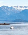
Nord2AK: Nordhavn's 2016 Rendezvous
The seeds were planted in 2012. We had been cruising for several weeks in the remote waters of northern British Columbia, where it isn’t unusual to go for several days without seeing another boat. Then surprisingly, two other Nordhavns sailed into Sea Otter Cove where we were anchored on the west side of Vancouver Island.
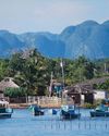
Cuban Sojourn
The second part of a journey along Cuba’s northern coast.

Shop Talk
Daniel Harper Q&A Founder & CEO of Siren Marine talks with us about how marine products are beginning to take advantage of onboard data.
Bye, Bye, Birdie #5
The Need for Speed
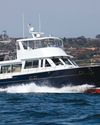
On The Water Duffield 58
It’s not every day that a brand-new 58-foot performance trawler appears on the marketplace radar, but that seems to have happened with the debut of the Duffield 58 Motoryacht.
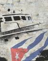
Castro's Mystery Motoryacht
Gianma and the voyage that changed the world.

Bye, Bye, Birdie #6
A Star to Steer Her By.
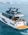
Glass Living
Testing the Modern and Versatile Okean 50.
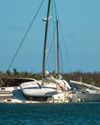
Navionics Spearheads Post-Irma Re-Mapping Effort
Boaters Can Contribute Cartography And Debris/Wreck Locations.
Coping With Fog
Dealing With One of the Most Dangerous Elements of Seamanship.